|


| |
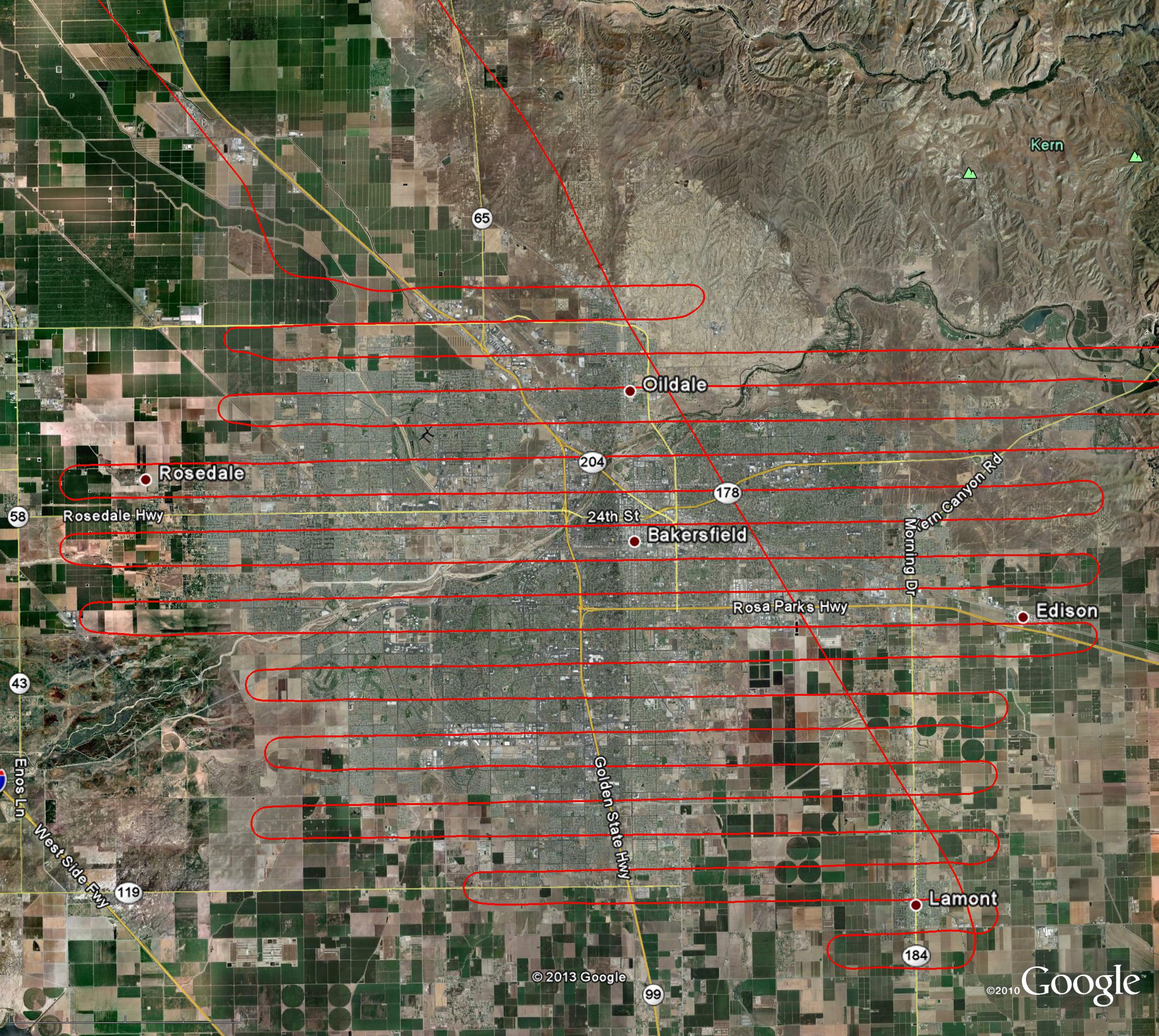
Sample Flight Path
| Pictured is the Google Earth view of a 150 square mile survey, conducted on
eptember 19, 2012 over Kern, CA. The flight lines were approximately 15 miles
in length and 3,170 feet apart. These tracks are often accurate to within 20 feet of our GPS plans,
thanks to our seasoned former airline pilots. Such accuracy ensures that
side-to-side overlap on images is sufficient enough to mosaic images if
requested by the customer. Our stringent flight path standards ensure that Air
Traffic Control understands our intentions even in the busiest of urban airspace
like that of San Francisco and Los Angeles. |

|